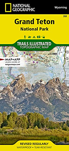
Grand Teton National Park Map (National Geographic Trails Illustrated Map, 202)
Product ID: 120940250
Condition: USED (All books in used condition)
Payflex: Pay in 4 interest-free payments of R160.75. Learn more
R 643
includes Duties & VAT
Delivery: 10-20 working days
Ships from USA warehouse.
Secure Transaction
VISA
Mastercard
payflex
ozow
Condition: USED (All books in used condition)
Product Description
Condition - Very Good
The item shows wear from consistent use but remains in good condition. It may arrive with damaged packaging or be repackaged.
Grand Teton National Park Map (National Geographic Trails Illustrated Map, 202)
- Topographic map. Outdooor recreation map. Hiking trails.
- Regularly revised. UTM grid is printed on the map to aid with GPS navigation. Waterproof.
- Tear-resistant. Backcountry campsites and zones. Trail descriptions.
- Jedediah Smith Wilderness. National Elk Refuge. Detailed map of Grand Teton Area.
- Comprehensive recreational map of Wyoming's Grand Teton National Park. Information on Fort Meade Recreation Area, Black Hills Experimental Forest, Bridger Teton National Forest, Caribou Targhee National Forest, Deerfield Lake, Jedediah Smith and Gros Ventre Wilderness areas, John D. Rockefeller Jr. Memorial Parkway, Colter Bay Village, Sturgis and Jackson, Snow King Mountain, Jackson Hole Mountain Resort, and Grand Targhee Resort
Technical Specifications
Country
USA
Brand
National Geographic
Manufacturer
National Geographic Maps
Binding
Map
ItemPartNumber
TI00202
Warranty
Limited Warranty
Color
One Color
Size
One Size
UnitCount
1
Format
Folded Map
UPCs
749717009813
EANs
9781566954372
You might also like

Input, Interaction, and the Second Language Learner (Routledge Linguistics Classics)

World English 1: Student's Book

Voices 3 with the Spark platform (AME)

Experiencing Speech: A Skills-Based, Panlingual Approach to Actor Training: A Beginner's Guide to Knight-Thompson Speechwork®

Looseleaf for Communication Research: Asking Questions, Finding Answers

English in Action 1 with the Spark platform (English in Action, Third Edition)

Voices 7 with the Spark platform (AME)

Voices 2 with the Spark platform (AME)