
Northern Michigan All-Outdoors Atlas & Field Guide
Product Description
Condition - Very Good
The item shows wear from consistent use but remains in good condition. It may arrive with damaged packaging or be repackaged.
Northern Michigan All-Outdoors Atlas & Field Guide
This large format, 15.5 x 11 , 176-page, spiral bound, full-color book is your complete guide to all of the outdoor activities in the area with unmatched information including public land boundaries, hunting areas, designated use areas, access to streams and lakes, designated trout fisheries, public and private camping locations, county and state parks, state and national forests, snowmobile, off-roading, biking, hiking and skiing trails, canoe routes, wildlife viewing destinations, scenic drives, golf courses - virtually anything and everything this region s great outdoors has to offer! This unmatched level of detail is made possible by splitting the state up into two regions. If you are serious about your outdoors and want to spend more time doing and less time pondering, this is an absolute must-have addition to your reference library!
Technical Specifications
You might also like

DeLorme® Michigan Atlas & Gazetteer (Delorme Atlas & Gazeteer)

Michigan County Atlas - Third Edition
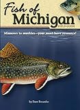
Fish of Michigan Field Guide (Fish Identification Guides)

Easy To Read: Michigan State Map (Rand McNally Easy to Read!)

Canoeing Michigan Rivers: A Comprehensive Guide to 45 Rivers, Revise and Updated

DeLorme® Wisconsin Atlas & Gazetteer (Delorme Atlas & Gazeteer)