
AMC Map: Franconia - Pemigewasset: White Mountains Trail Map
Product Description
Condition - Very Good
The item shows wear from consistent use but remains in good condition. It may arrive with damaged packaging or be repackaged.
AMC Map: Franconia - Pemigewasset: White Mountains Trail Map
- AMC FRANCONIA-PEMIGEWASSET
Waterproof and lightweight, this Franconia–Pemigewasset map includes detailed maps of Franconia Notch State Park and Waterville Valley, as well as hiking information. Printed in full-color on waterproof Tyvek, this fully updated map includes comprehensive trail coverage of the stunning Pemigewasset Wilderness Area along with the popular Kancamagus Highway. On the reverse are detailed maps of Franconia Notch State Park and Waterville Valley, plus safety and planning tips and emergency information. GPS-rendered, this map is tear-resistant, has an easy-to-read scale, and includes trail segment mileage.
Technical Specifications
You might also like

AMC Map: Presidential Range: White Mountains Trail Map (Adventure Series)

White Mountain Guide: AMC's Comprehensive Guide To Hiking Trails In The White Mountain National Forest (Appalachian Mountain Club White Mountain Guide)

AMC's Best Day Hikes in the White Mountains: Four-season Guide to 60 of the Best Trails in the White Mountain National Forest
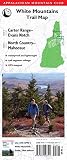
AMC Map: Carter Range - Evans Notch and North Country - Mahoosuc: White Mountains Trail Map (Appalachian Mountain Club)

Southern New Hampshire Trail Map: Mount Monadnock (with historic features) / Sunapee and Pillsbury State Parks / Mount Cardigan / Belknap Range (Appalachian Mountain Club)

The 4000-Footers of the White Mountains

AMC's Best Backpacking in New England: A Guide To 37 Of The Best Multiday Trips From Maine To Connecticut

White Mountains Waterproof Trail Map: New Hampshire & Maine

Waterfalls of the White Mountains: 30 Hikes to 100 Waterfalls