
Appalachian Trail Guide to Tennessee-North Carolina
Product Description
Condition - Very Good
The item shows wear from consistent use but remains in good condition. It may arrive with damaged packaging or be repackaged.
Appalachian Trail Guide to Tennessee-North Carolina
- ATC Map & Guide set for Appalachian Trail in Tennessee & North Carolina
- Easy to use and comprehensive
- Multi color maps printed on waterproof, tear resistant paper
- Includes an ATC ziploc bag to keep the maps and book clean and dry while hiking
- Includes - Great Smoky Mountains National Park at Fontana Dam, North Carolina. Includes parts of the Cherokee and Pisgah National Forest and the park
The official guide to 303 miles of the Appalachian Trail, from Damascus, Va., near the Tennessee line south to the southern end of the Great Smoky Mountains National Park at Fontana Dam, N.C. This area includes the spectacular southern balds, the Highlands of Roan, and Cherokee National Forest, as well as the most-visited of the traditional national parks. The six detached maps (three sheets) included in the packet are water- and tear-resistant in seven colors at a scale of an inch to a mile, with elevation profiles. The book includes detailed trail descriptions as well as thorough background information on towns, historical sites, and geology.
Technical Specifications
You might also like

Appalachian Trail Guide to North Carolina-Georgia (Official Appalachian Trail Guides)

Appalachian Trail Data Book (2015)

The A.T. Guide Northbound 2016

Appalachian Trail Guide to Southwest Virginia (Official Appalachian Trail Guides)

Appalachian Trail Data Book (2016)
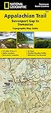
Appalachian Trail, Davenport Gap to Damascus [North Carolina, Tennessee] (National Geographic Trails Illustrated Map)

Great Smoky Mountains National Park (National Geographic Trails Illustrated Map)

Appalachian Trail Guide to Shenandoah National Park

Appalachian Trail Thru-Hikers' Companion (2016)

Appalachian Trail Thru-Hikers' Companion (2015)