![Baxter State Park Map [Mount Katahdin, Katahdin Iron Works] (National Geographic Trails Illustrated Map, 754)](https://m.media-amazon.com/images/I/51hgeY5SMlL._SL500_.jpg)
Baxter State Park Map [Mount Katahdin, Katahdin Iron Works] (National Geographic Trails Illustrated Map, 754)
Product Description
Condition - Very Good
The item shows wear from consistent use but remains in good condition. It may arrive with damaged packaging or be repackaged.
Baxter State Park Map [Mount Katahdin, Katahdin Iron Works] (National Geographic Trails Illustrated Map, 754)
- Features the Appalachian Trail, KI-JO Mary Forest, Katahdin Iron Works and Roach Ponds, Maine Parks, and Public Reserved Lands. Each map is based on exact reproductions of USGS topographic map information, updated, customized, and enhanced to meet the unique features of each area. GPS compatible with full ATM grid.
- Printed on waterproof, tear-resistant material with a plastic coating that offers supreme durability with a new color palette and stunning shaded relief. Includes detailed trail information, campground/camping sites, points of interest, trailheads, picnic areas, facilities, and more. Includes valuable wilderness tips and Leave No Trace guidelines.
- Dimensions: 4.25 x 9.25 in. folded; 25.5 x 38 in. fully opened. Scale: 1:63,360 (& 1:83,333). 2011 edition.
• Waterproof • Tear-Resistant • Topographic Map
Governor Percival P. Baxter so enjoyed vacationing in the Maine woods as a child, he purchased nearly 6,000 acres of land in 1930 to fulfill his dream of creating a park. The park that bears his name now covers 209,501 acres and includes Mount Katahdin, Maine's highest peak. National Geographic's Trails Illustrated map of Baxter State Park combines unmatched detail with helpful information to offer an invaluable tool for making the most of your visit. Expertly researched and created in partnership with local land management agencies, this map features key points of interest including Katahdin Iron Works, Borestone Mountain, Trout Brook Farm, and South Branch Pond.
With over 200 miles of hiking trails including a portion of the Appalachian Trail, this map will prove invaluable in your exploration of the park. Trail mileage between intersections will help you choose the path that's right for you. The map base includes contour lines and elevations for summits, passes and many lakes. Some of the recreation features noted include campgrounds, trailheads, interpretive trails, picnic areas, rental cabins, boating access, and canoe carry down points.
Every Trails Illustrated map is printed on "Backcountry Tough" waterproof, tear-resistant paper. A full UTM grid is printed on the map to aid with GPS navigation.
Other features found on this map include: Mount Katahdin, Pemadumcook Lake, Sebec Lake, Traveler Mountain, White Cap Mountain.
- Map Scale = 1:63,360
- Sheet Size = 25.5" x 37.75"
- Folded Size = 4.25" x 9.25"
Technical Specifications
Customers who bought this also bought


You might also like

Hiking Maine's Baxter State Park: A Guide to the Park's Greatest Hiking Adventures Including Mount Katahdin (Regional Hiking Series)
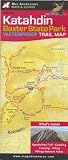
Katahdin; Baxter state Park Trail Map

Acadia National Park (National Geographic Trails Illustrated Map)

White Mountain National Forest [Map Pack Bundle] (National Geographic Trails Illustrated Map)

AMC Map: Baxter State Park - Katahdin and 100-Mile Wilderness: Maine Mountains Trail Map

Maine Mountain Guide: AMC's Comprehensive Guide to the Hiking Trails of Maine, Featuring Baxter State Park and Acadia National Park

Acadia National Park Waterproof Trail Map, Maine
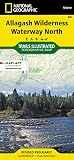
Allagash Wilderness Waterway North (National Geographic Trails Illustrated Map (400))

Hiking Acadia National Park: A Guide To The Park's Greatest Hiking Adventures (Regional Hiking Series)