
Collins Discovering Glasgow: The Illustrated Map
Product Description
Condition - Very Good
The item shows wear from consistent use but remains in good condition. It may arrive with damaged packaging or be repackaged.
Collins Discovering Glasgow: The Illustrated Map
This map displays delightful watercolor mapping, with individual paintings of all the main sights and landmarks in the city. Covers the center of Glasgow from the Botanic Gardens in the north and the new Riverside Museum to the west to the 12th century Cathedral and the gritty Barras Market to the east. Further mapping stretches southwest to Pollok Park and the Burrell Collection. The map features historical and contemporary anecdotes; popular areas at larger scale, hundreds of shops, restaurants, cafés and bars; comprehensive travel information and index; shop by shop street maps of Buchanan Street and the Merchant City; and railway stations, bus routes, taxi ranks and car parks.Â
Technical Specifications
You might also like

Streetwise Edinburgh Map - Laminated City Center Street Map of Edinburgh, Scotland (Michelin Streetwise Maps)

Discovering Edinburgh Illustrated Map
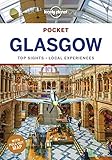
Lonely Planet Pocket Glasgow (Travel Guide)

Discovering Edinburgh Illustrated Map

Collins Pocket Map Glasgow

Rick Steves Scotland Planning Map: Including Edinburgh & Glasgow City Maps (Rick Steves Planning Maps)

DK Eyewitness Travel Guide Scotland

Fodor's Essential Scotland (Travel Guide)

Streetwise Dublin Map - Laminated City Center Street Map of Dublin, Ireland (Michelin Streetwise Maps)
Streetwise London Map - Laminated City Center Street Map of London, England (Michelin Streetwise Maps)