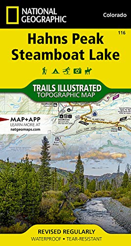
Hahns Peak, Steamboat Lake Map (National Geographic Trails Illustrated Map, 116)
Product ID: 1566952808
Condition: USED (All books in used condition)
Payflex: Pay in 4 interest-free payments of R299.75. Read the FAQ
R 1,199
includes Duties & VAT
Delivery: 10-20 working days
Ships from USA warehouse.
Secure Transaction
VISA
Mastercard
payflex
ozow
Product Description
Condition - Very Good
The item shows wear from consistent use but remains in good condition. It may arrive with damaged packaging or be repackaged.
Hahns Peak, Steamboat Lake Map (National Geographic Trails Illustrated Map, 116)
- Hahns Pk / Steamboat Lake #116
• Waterproof • Tear-Resistant • Topographic Map
Coverage includes Routt National Forest, Mt Zirkel Wilderness, and Pearl Lake and Steamboat Lake state parks. Also includes the cities of Hahns Peak and Pearl, as well as Steamboat, Big Creek, Boettcher, Gilpin and Bear lakes and the Frying Pan Basin. Includes UTM grids for use with your GPS unit.
Coverage includes Routt National Forest, Mt Zirkel Wilderness, and Pearl Lake and Steamboat Lake state parks. Also includes the cities of Hahns Peak and Pearl, as well as Steamboat, Big Creek, Boettcher, Gilpin and Bear lakes and the Frying Pan Basin. Includes UTM grids for use with your GPS unit.
- Map Scale = 1:40,680
- Sheet Size = 22" x 32"
- Folded Size = 4" x 7.5"
Technical Specifications
Country
USA
Brand
Natl Geographic Society Maps
Manufacturer
Natl Geographic Society Maps
Binding
Map
ItemPartNumber
9781566952804
UnitCount
1
Format
Folded Map
UPCs
749717009462
EANs
0749717011168
You might also like

Clark, Buffalo Pass (National Geographic Trails Illustrated Map)
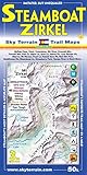
Steamboat Springs Mount Zirkel Trail Map 3rd Edition

Steamboat Springs, Rabbit Ears Pass (National Geographic Trails Illustrated Map)

Walden, Gould (National Geographic Trails Illustrated Map)

Cowdrey, North Sand Hills (National Geographic Trails Illustrated Map)