
Moab North (National Geographic Trails Illustrated Map, 500)
Product Description
Condition - Very Good
The item shows wear from consistent use but remains in good condition. It may arrive with damaged packaging or be repackaged.
Moab North (National Geographic Trails Illustrated Map, 500)
This detailed recreation map contains carefully researched trails, campsites, BLM roads, The Colorado River Way area and Colorado River mileages, Green River mileages, Fisher Towers, and points-of-interests. Detailed Trail Charts describing the Mountain Bike and Jeep Trails are included. These charts include mileages and difficulty ratings to better help you plan your trip. Also included is information on Mountain Biking and Desert Safety. Useful UTM and Latitude/Longitude grids are included to help you locate yourself in the backcountry. State and Private lands are also shown.
Moab North: Includes Arches National Park, the Kokopelli Trail, and portions of the Manti-La Sal National Forest. This map includes overlap with TI-703 (Manti La Sal National Forest). In addition, this map will also overlap with TI-208 (Colorado National Monument).
Moab North Back: Includes highly detailed insets and enhanced coverage for Moab's most popular Mountain Biking and Jeep Route areas. These insets include; Monitor and Merrimac Buttes, Bartlett Wash, the Sovereign Trail, the town of Moab, Slickrock and Porcupine Rim, Green River and Ten Mile Point.
- Folded Size = 4.25 x 9.25
- Sheet Size = 37.75 x 25.5
- Scale = 1:70,000
Technical Specifications
You might also like

Moab [Map Pack Bundle] (National Geographic Trails Illustrated Map)

National Geographic Trails Illustrated Map, 210 Canyonlands UT

Arches National Park (National Geographic Trails Illustrated Map)
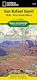
San Rafael Swell [BLM - Price Field Office] (National Geographic Trails Illustrated Map)

Manti-La Sal National Forest (National Geographic Trails Illustrated Map)

Canyons of the Escalante [Grand Staircase-Escalante National Monument] (National Geographic Trails Illustrated Map)

Zion National Park (National Geographic Trails Illustrated Map)

Capitol Reef National Park (National Geographic Trails Illustrated Map)

Bryce Canyon National Park (National Geographic Trails Illustrated Map)

Grand Gulch, Cedar Mesa Plateau [BLM - Monticello Field Office] (National Geographic Trails Illustrated Map)