
New York Recreation Atlas (National Geographic Recreation Atlas)
Product ID: 1597755540
Condition: USED (All books in used condition)
Payflex: Pay in 4 interest-free payments of R393.00. Learn more
R 1,572
includes Duties & VAT
Delivery: 10-20 working days
Ships from USA warehouse.
Secure Transaction
VISA
Mastercard
payflex
ozow
Product Description
Condition - Very Good
The item shows wear from consistent use but remains in good condition. It may arrive with damaged packaging or be repackaged.
New York Recreation Atlas (National Geographic Recreation Atlas)
National Geographic's New York Recreation Atlas is the ideal resource for any recreation activity from hunting and fishing to camping, golfing, hiking, and more. This durable, easy-to-use atlas includes up-to-date topographic maps, a comprehensive road network, informative recreation guides, and a detailed index. All road types are clearly identified, making each atlas a useful planning tool for motorcycle and off-road adventures. Maps include bold boundaries for parks and federal lands, and clearly labeled lakes, rivers, and streams. On each map page you will find a convenient map legend, easy-to-read page numbers, a latitude and longitude grid for use with GPS, and fact-checked points-of-interest. Also included are cross-referenced charts of fishing areas with species information, game management units, campgrounds and attractions charts, state park maps and facilities, hiking, golfing, skiing and paddling destinations, climate information, and more.
• Detailed topographic maps with shaded relief for the entire state. Map scale is 1:150,000
• Each labeled feature is up-to-date and verified by satellite image
• Comprehensive, easy-to-read road network
• Boundaries for parks and federal lands
• Clearly-labeled lakes, rivers and streams
• Durable laminated cover
• Size 11"x15"
• Robust travel and recreation information
- Cross-referenced chart of fishing areas with species information
- Game management units
- Campgrounds and attraction charts
- State Parks maps and facilities
- Hiking, golfing, skiing and paddling destinations
- Climate information
- Map Scale = 1:150,000
- Folded Size = 10.75" x 15.5"
Technical Specifications
Country
USA
Brand
Natl Geographic Society Maps
Manufacturer
Natl Geographic Society Maps
Binding
Paperback
ItemPartNumber
20458200012
UnitCount
1
UPCs
749717104716
EANs
9781597755542
You might also like

Pennsylvania Recreation Atlas (National Geographic Recreation Atlas)

Easy To Read: New York State Map (Rand McNally Easy to Read!)
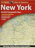
DeLorme® New York Atlas & Gazetteer

Virginia Recreation Atlas (National Geographic Recreation Atlas)

Western New York All-Outdoors Atlas

Connecticut/Rhode Island Atlas and Gazetteer (Delorme Atlas & Gazetteer)

Easy To Fold: New York (Easyfinder Maps)
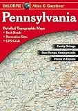
DeLorme® Pennsylvania Atlas & Gazetteer (DeLorme Atlas & Gazetteer)

Minnesota Recreation Atlas (National Geographic Recreation Atlas)