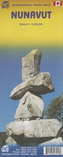
Nunavut Travel map ITMB
Product Description
Condition - Very Good
The item shows wear from consistent use but remains in good condition. It may arrive with damaged packaging or be repackaged.
Nunavut Travel map ITMB
The far north of Canada, north of 60 degrees, consists of three territories; the Yukon, the Northwest Territories, and Nunavut. Until now, there has never been a proper map of the territory that was carved off from the NWT a quarter century ago. With only 30,000 people and a scattering of settlements, Nunavut is larger than western Europe in area. This map took years to prepare, using 1:250,000 scale government topo maps as a base and tracing thousands of little lakes. The traditional passageway of the fabled Northwest Passage is also shown. The most northerly civilian community in the world is on the map Grise Bay, as well as Alert, the most remote place on earth.
Technical Specifications
You might also like

Northwest Territories 1:3,000,000 Travel Map

1. Greenland and Northpole Travel Reference map 1:3M/1:9M **2010** (International Travel Maps)

Yukon Territory 1: 1 000 000 inclue: Dawson, Watson Lake and Whitehorse inset (International Travel Maps)
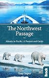
The Northwest Passage: Atlantic To Pacific: A Portrait And Guide (Bradt Travel Guides)

Arctic: A Guide To Coastal Wildlife (Bradt Guides)