Rand McNally Baltimore, Maryland Street Map
Product Description
Condition - Very Good
The item shows wear from consistent use but remains in good condition. It may arrive with damaged packaging or be repackaged.
Rand McNally Baltimore, Maryland Street Map
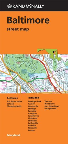
Rand McNally's folded map for Baltimore is a must-have for anyone traveling in and around this part of Maryland, offering unbeatable accuracy and reliability at a great price. Our trusted cartography shows all Interstate, U.S., state, and county highways, along with clearly indicated parks, points of interest, airports, county boundaries, and streets. The easy-to-use legend and detailed index make for quick and easy location of destinations. You'll see why Rand McNally folded maps have been the trusted standard for years. Regularly updated Full-color maps Clearly labeled Interstate, U.S., state, and county highways Indications of parks, points of interest, airports, county boundaries, schools, shopping malls, and vicinity maps Enlargements of downtown Easy-to-use legend Detailed & full street index Convenient folded size 2013Communities Included: Brooklyn Park, Carney, Catonsville, Elkridge, Fernale, Hampton, Lansdowne, Linthicum, Lochearn, Lutherville, Parkville, Pikesville, Ruxton
Technical Specifications
You might also like

111 Places in Baltimore That You Must Not Miss (111 Places in .... That You Must Not Miss)

Rand McNally Folded Map: Washington, D.C. & Baltimore (Regional Map)

Walking Baltimore: An Insider's Guide to 33 Historic Neighborhoods, Waterfront Districts, and Hidden Treasures in Charm City

Rand McNally Easy To Read: Delaware, Maryland State Map

Moon Baltimore

Rand Mcnally Washington D.C. Street Map (Red Cover)

MallSmart Washington DC Map by VanDam -- Laminated City Street pocket map with all museums, sights, monuments, government buildings and hotels plus ... Map - Folded Map, 2020 Edition (Streetsmart)

Streetwise Washington DC Map - Laminated City Center Street Map of Washington, DC (Michelin Streetwise Maps)