
Baltimore, Maryland City & County Street Atlas
Product Description
Condition - Very Good
The item shows wear from consistent use but remains in good condition. It may arrive with damaged packaging or be repackaged.
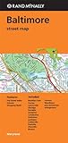
Baltimore, Maryland City & County Street Atlas
The Baltimore, MD City and County Atlas is a full-color street atlas, including: complete Baltimore County coverage, Hampstead, and Downtown Baltimore, at a large-scale; and features: Baltimore/Washington International Thurgood Marshall Airport (BWI), Block Numbers, Downtown Baltimore, Colleges and Universities, Baltimore Metro & Central Light Rail, Maryland Rail Commuter System, Parks and Rec Areas, Places of Interest, Schools, and ZIP Codes
Technical Specifications
You might also like

Anne Arundel County, Maryland Street Atlas
Rand Mcnally Folded Map: Baltimore Street Map

Howard County, MD Street Atlas

Walking Baltimore: An Insider's Guide to 33 Historic Neighborhoods, Waterfront Districts, and Hidden Treasures in Charm City

Washington, DC Metro Street Atlas

Streetwise Miami Map - Laminated City Center Street Map of Miami, Florida - Folding pocket size travel map with metrorail

Prince George's County, Maryland Street Atlas

Montgomery County, Maryland Street Atlas

Harford County, MD Street Atlas

Virginia State Northern Street Atlas